These questions were asked in December 2012, following answers received from Richard Braddell 1 Feb 2013.
It does not sound like they are making much progress.
As of February 2014 2630 claims are still held in apportionment.
____________
1. Are there 2770 TC3 claims held in apportionment? (Oct 2012)
All claims for building damage have to be apportioned. There are currently about 2000 TC3 properties where apportionment is required before the claim can be determined as over- or under-cap. In all there have been approximately 28,000 properties with claims in TC3 and 14,000 have been handed to private insurers.
2. Is the value of these claims on average 150.000, total of over 4bn?
No. The 2000 claims awaiting apportionment all have a damage value of over $80,000, but it is not immediately apparent that damage from any one event is over $100,000 +GST. That is why they need apportionment before a private insurer will accept them, if over cap.
3. Is it true that EQC claimed this damage from re-insurers last year based on best estimate?
No. We claim on the basis of proved the loss from an event. EQC pays the first $1.5 billion of an event and we draw down from the reinsurers as we prove the loss and settle for the balance of claims from that event.
4. Is EQC investing these moneys in Government Stock earning interest?
No, EQC is using reinsurance payouts to settle claims and repair houses. You may be confusing these pay-outs with the funds in the Natural Disaster Fund (which is also being drawn down for repairs and claims settlement) some of which were invested in Government bonds.
5. Did the Government free EQC from interest payments on the overdue payments?
EQC has never had a liability for interest on pay-outs from natural disaster damage.
6. Are these 2770 TC3 claims in apportionment considered the worst affected in Christchurch?
By definition, the worst affected buildings in Christchurch have been settled by EQC as over-cap, and passed to private insurers for resolution. Properties awaiting apportionment before the claim can be determined as over- or under-cap, are those with damage over $80,000 but where it is not immediately apparent that damage from any one event is over $100,000 +GST.
7. Is it true that the cost of drilling will take most of these claims over-cap?
No. The actual cost of drilling varies as a proportion of the individual properties’ claims values.
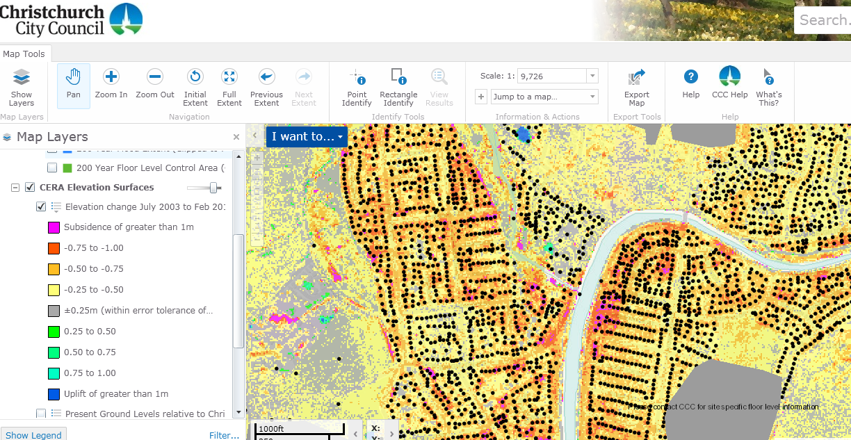
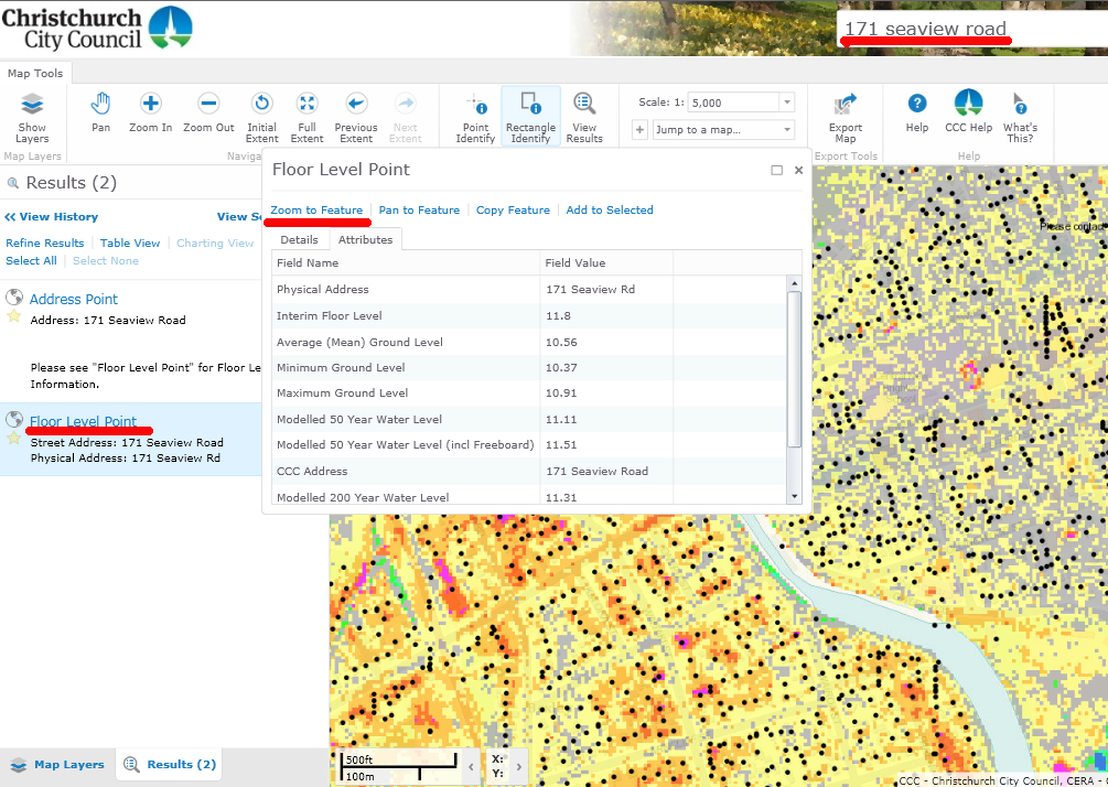
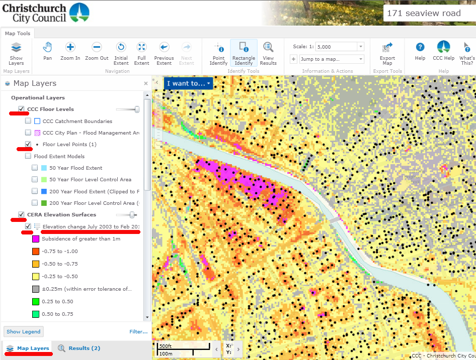
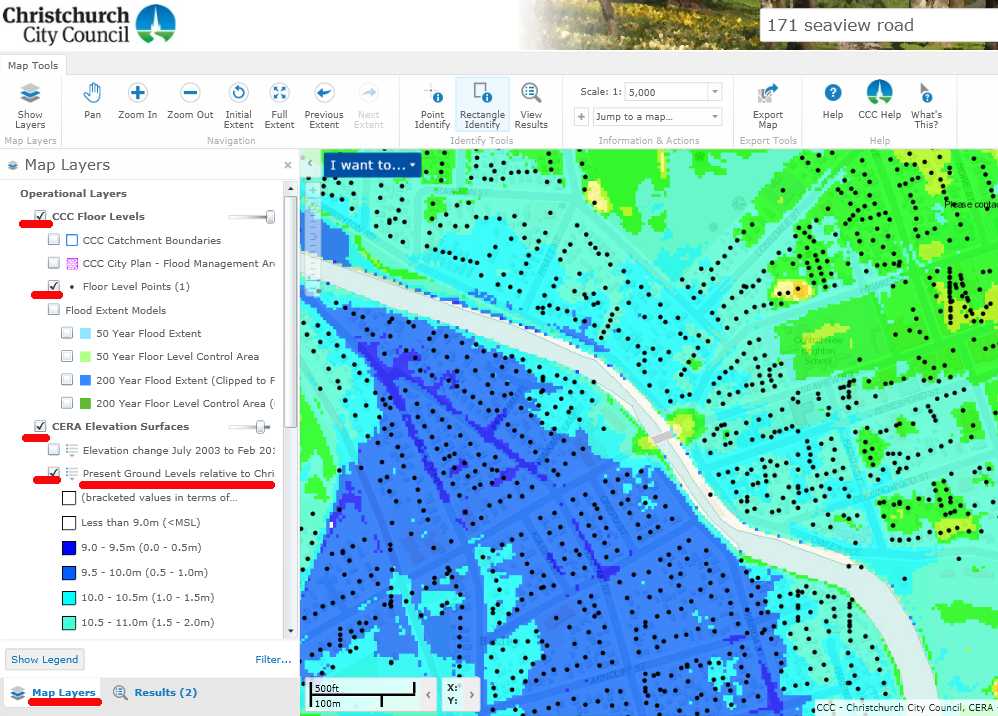
Drilling was dependent on whether there was damage to foundations and the majority of properties in TC3 did not require drilling. The geotechnical investigations in Technical Category 3 (TC3) were undertaken in order to understand local soil conditions before the foundations of approximately 10,500 homes can be repaired or replaced.
Until drilling data is analysed, it’s not possible to say what these foundation repair costs will be. While it’s likely that TC3 foundations will cost more than conventional foundations, the cost must take damage from one event over the $100,000 +GST cap for the claim to be accepted by a private insurer.
8. Is it true that the 10% increase in building cost will take most of these claims over-cap?
One of the reasons EQC established the Canterbury Home Repair Programme with Fletcher EQR was to reduce the impact of cost increases in the repair trades by setting ‘rate ceilings’ which reflect normal market costs for building and finishing trades. This has been successful in keeping costs increases to a minimum – in many trades, costs have decreased since 2010.
The reported 10% increase in costs affects predominantly new builds, which EQC is not involved in.
9. What information is missing to finish these apportionments / settlements?
This varies form case to case, but due to the frequency of earthquakes in 2010 and 2011, the key missing information is usually evidence of damage between earthquakes which helps fix the costs to one event or another. EQC is using a range of tools to manually replicate this information.
10. Is it fair to say that both EQC and the Government are financially benefitting from the suffering of the worst affected Christchurch residents?
No. EQC has an estimated liability of $12.5 billion of which $1 billion is likely to be met by the taxpayer. Figures for the total cost to the government can be obtained from Treasury, it is substantially more than for EQC alone.